
 Facebook
 X
X
 Pinterest
 Copy Link
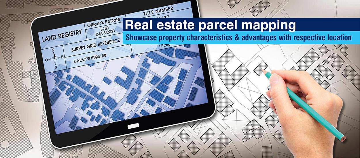
HOW TO READ LAND PARCELS, APNS, AND PLAT MAPS IN MADERA COUNTY
Buying land in Madera County isn’t just about finding a beautiful property. To make smart investments, you need to understand parcel maps, APN numbers, and plat maps. Many first-time buyers overlook this step, which can lead to surprises like disputed boundaries, incorrect zoning, or inaccessible parcels.
This guide will walk you step-by-step through:
-
Understanding APN numbers
-
Navigating Madera County GIS and plat maps
-
Interpreting parcel boundaries and legal descriptions
-
Using this information to make informed investment decisions
1. What is an APN (Assessor’s Parcel Number)?
The Assessor’s Parcel Number (APN) is a unique identifier assigned to each property by the county assessor. Think of it as a social security number for land. It allows you to look up ownership, zoning, taxes, and legal information for each parcel.
APN Structure in Madera County
-
Typically written as 123-456-789
-
The first set identifies the map book
-
The second set identifies the page within the map
-
The third set identifies the specific parcel
-
Why APNs matter:
-
Verify ownership and legal boundaries
-
Check zoning and land use restrictions
-
Identify potential easements, rights-of-way, or encroachments
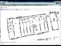
2. Reading a Madera County Parcel Map
Parcel maps provide a visual representation of property lines, easements, and lot dimensions. Madera County maintains a GIS (Geographic Information System) online portal, which allows buyers to:
-
View property boundaries and acreage
-
Identify neighboring parcels and ownership
-
Check road access and utility connections
-
 Overlay zoning or flood/fire hazard maps
 Overlay zoning or flood/fire hazard maps
Step-by-Step Guide
-
Access the GIS portal: Visit Madera County GIS
-
Search by APN: Enter the parcel number to locate your property
-
Toggle layers: Turn on zoning, flood zones, and roads for context
-
Measure distances: Use measurement tools to check frontage, setbacks, or acreage
Pro Tip: Take screenshots of the parcel map for your due diligence records. It’s essential if you’re working with a lender or a title company.
3. Understanding Plat Maps
While parcel maps focus on individual properties, plat maps show subdivisions, easements, and the legal layout of multiple parcels within a tract. They are particularly useful if you’re considering:
-
Buying a lot in a subdivision
-
Subdividing property yourself
-
Verifying legal descriptions for development
Plat Map Details to Note:
-
Lot dimensions and shape
-
Roadways, sidewalks, and easements
-
Public utility lines or restricted areas
Where to Access: Madera County Recorder’s Office or online GIS portal.
4. Legal Descriptions vs. Parcel Maps
Every parcel has a legal description in addition to its APN and map. This is the official wording used in deeds and titles. Legal descriptions may include:
-
Metes and bounds: Distance and direction from landmarks or survey markers
-
Lot and block: For subdivision parcels
-
Government lot: Often used in rural or agricultural parcels
Why it matters:
-
Confirms the exact property boundaries
-
Necessary for surveys, title insurance, and construction permits
-
Helps prevent disputes with neighbors
5. Using GIS Tools to Make Smarter Investment Decisions
Madera County’s GIS portal allows investors to layer multiple datasets for better decision-making. Key layers include:
-
Zoning maps – Know what you can legally build
-
Fire hazard maps – Identify wildfire-prone areas
-
Flood zones – Determine need for special permits or insurance
-
Parcel size & topography – Assess buildability and development potential
Investor Tip: Always cross-check GIS data with a licensed surveyor before purchasing.
6. Practical Examples for Investors
Scenario 1: Verifying Road Access
-
Parcel looks accessible on a map but check if it’s a public road or private easement. GIS layers will show legal road access.
Scenario 2: Checking Buildable Area
-
Parcel may be 5 acres, but steep slopes or flood zones reduce usable land. Overlay topography and flood layers.
Scenario 3: Combining APNs for Bulk Purchases
-
Investors buying adjacent parcels can verify contiguous ownership using APNs. GIS tools help visualize combined acreage.
7. Common Mistakes Buyers Make
-
Ignoring easements: You may not legally build in certain areas.
-
Assuming access: Roads may not be public, leading to disputes.
-
Misreading APN numbers: Confusing parcels can result in purchasing the wrong land.
-
Skipping GIS verification: Online listings alone are not sufficient.
Solution: Follow the steps outlined here, and always hire a local agent or surveyor for verification.
8. Conclusion: Why Reading Parcels and APNs Matters
Investing in land without understanding parcel maps and APNs is like buying a home without seeing the floor plan. For Madera County land investors, this knowledge:
-
Prevents costly mistakes
-
Ensures legal and physical access
-
Supports long-term investment decisions
By combining APN lookup, GIS tools, plat maps, and legal descriptions, you’ll be equipped to invest with confidence in foothill acreage, agricultural land, or residential lots.


